North Carolina is home to a diverse landscape that ranges from the Appalachian Mountains to the Atlantic Coast. This quality makes the state a prime stomping ground for travelers who enjoy the more picturesque side of their surroundings and aren’t in a rush to make it to the next stop on a tight itinerary. Like the rolling hills of North Carolina’s Piedmont region, the road adventurers who can truly appreciate our favorite scenic routes can roll with whatever they encounter and be all the more happy for it at the end of the day.
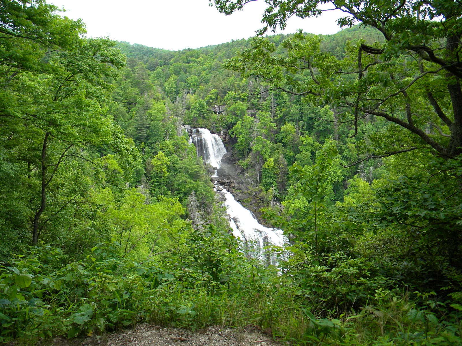
No. 10 – Whitewater Falls
Starting Location: Highlands, NC
Ending Location: Lake Toxaway, NC
Length: 24 miles
Best Season to Drive: All
See this drive on Google Maps
This winding and paved route passes through North Carolina’s waterfall country, with more waterfalls present than in any other portion of the state. The most impressive of these waterfalls is Whitewater Falls, about halfway through the trip in Cashiers. It is one of the highest falls in the eastern United States. There are also numerous marked recreation areas ideal for hiking, rock climbing, or picnics along the way.
No. 9 – Vilas to Elk Falls

Starting Location: Vilas, NC
Ending Location: Banner Elk, NC
Length: 20 miles
Best Season to Drive: Spring, Summer, and Fall
See this drive on Google Maps
This primarily paved road travels through the Pisgah National Forest, with ample opportunities to pull over and hike into the deep woods. Since the route isn’t very long, those wanting to lengthen it for a full morning or afternoon can stop in Boone to browse through wares in the historic Mast General Store and mingle with the locals. An Episcopal Mission between Boone and Banner Elk is another popular stop.
No. 8 – Linville Gorge

Starting Location: Linville Falls, NC
Ending Location: Table Rock, NC
Length: 16 miles
Best Season to Drive: All
See this drive on Google Maps
The road may be a little too rough for RVs or trailers, but the average car can manage this two-way route well with a bit of care. In the winter months, stop at Jonas Ridge for snow tubing the whole family can enjoy. Fall is when this drive really shines, with the changing of the leaves. Stop at Hawksbill Mountain for photos, and the hiking trails are supreme at Table Rock Picnic Area.
No. 7 – Roanoke Run

Starting Location: Rocky Mt, NC
Ending Location: Roanoke Rapids, NC
Length: 89 miles
Best Season to Drive: All
See this drive on Google Maps
This little-known route runs through a largely undeveloped stretch of alternating hills and flats. It veers east to the outskirts of the Roanoke River National Wildlife Refuge, then back northwest on an easy and paved two-lane road. In the historic town of Roanoke Rapids, travelers can admire the Elizabethan Gothic and Tudor architectural styles of many of the local structures or fish the nearby waters.
No. 6 – Inner Banks Tour
Starting Location: Bogue, NC
Ending Location: Manteo, NC
Length: 195 miles
Best Season to Drive: All
See this drive on Google Maps
This mainly seaside route explores the North Carolina coastline behind the barrier islands on the mainland, affording plenty of looks at a relatively calm portion of the Atlantic. The trip isn’t all about the saltwater though, passing through wooded areas like the Croatan National Forest. Travelers may wish to stop at the sleepy community of Stumpy Point within the Alligator River National Wildlife Refuge to see the setting of the popular novel Ender’s Game by Orson Scott Card.
No. 5 – Morrow Mountain State Park to Reed Gold Mine

Starting Location: Locust, NC
Ending Location: Midland, NC
Length: 54 miles
Best Season to Drive: All
See this drive on Google Maps
This drive through the Piedmont region’s rolling hills is ideal for a full-day or even weekend trip. At approximately the half-way point lies Lake Tillery, which is a great place to stop for lunch or take a dip in the warmer months. Then the route winds back east on a different road to Midland, where Reed Gold Mine is located, which was the first gold mine in the United States.
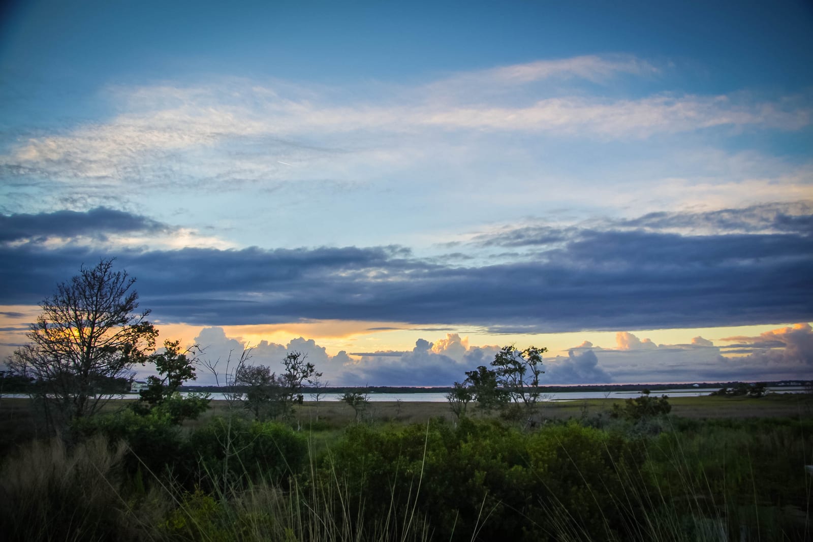
No. 4 – Cape Hatteras National Seashore

Starting Location: Kitty Hawk, NC
Ending Location: Hatteras, NC
Length: 62 miles
Best Season to Drive: All
See this drive on Google Maps
All along this route, views of the Atlantic Ocean’s rolling waves crashing onto white sand beaches abound. The first portion of the trip has plenty of places to stop and shop or grab a bite to eat, but the leg between Pea Island and Hatteras is largely undeveloped and full of natural beauty. A trip along this coast would not be complete without a stop at Cape Hatteras Lighthouse, which is likely the most famous lighthouse in the United States.
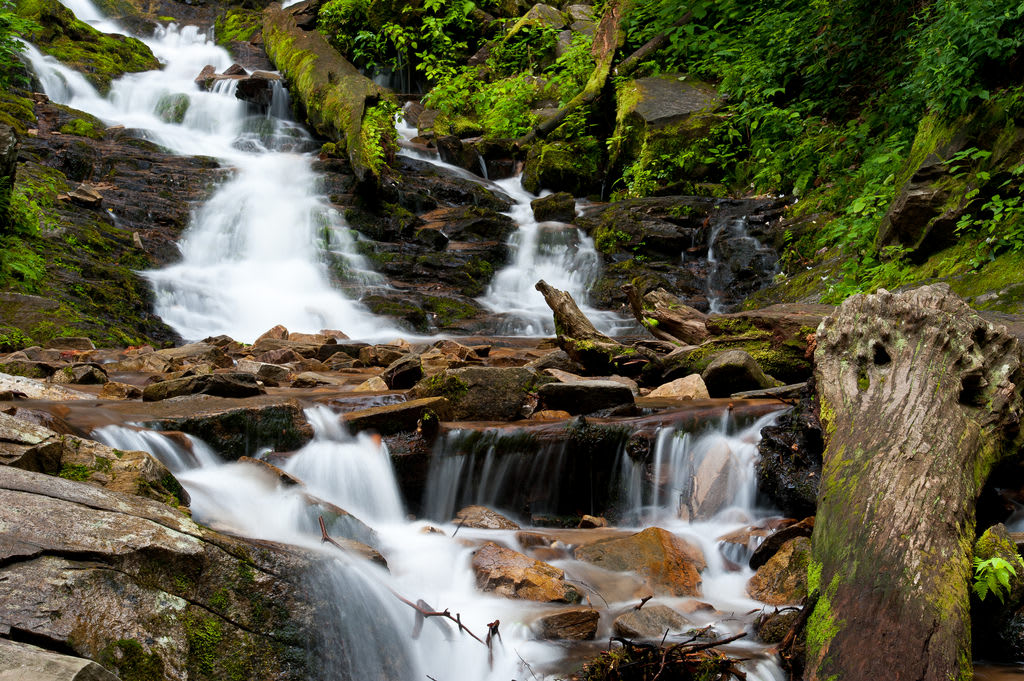
No. 3 – Heintooga-Round Bottom Road
Starting Location: Cherokee, NC
Ending Location: Balsam Mountain, NC
Length: 23 miles
Best Season to Drive: Spring, Summer, and Fall
See this drive on Google Maps
This route may not be suitable for RVs or vehicles pulling trailers and can be a little rough even in a sedan, but the ride makes up for any inconvenience with its spectacular views and little-known natural attractions. Be prepared to drive slowly (in the 15 mph range) and take time to stop and enjoy this portion of the Smoky Mountains few get to see. The fly fishing on Straight Creek is the stuff of legends, and Balsam Mountain provides the best photographing location on the trip.
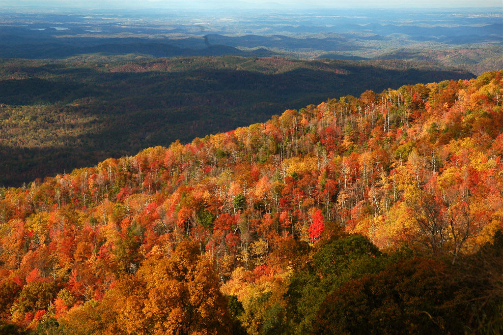
No. 2 – Blue Ridge Parkway

Starting Location: Airy, NC
Ending Location: Cherokee, NC
Length: 232 miles
Best Season to Drive: All
See this drive on Google Maps
Although the Blue Ridge Parkway actually extends into Virginia, magnificent views abound without ever leaving the state of North Carolina, and the drive is long enough to break into a weekend trip. The parkway is actually the longest linear park in the United States and runs along the Blue Ridge mountain chain of the Appalachian Mountains. Mount Mitchell, one of North America’s highest points, is a must-see along the way.
No. 1 – Cherohala Skyway
Starting Location: Joyce Kilmer Memorial Forest, NC
Ending Location: Robbinsville, NC
Length: 15 miles
Best Season to Drive: Spring, Summer, and Fall
See this drive on Google Maps
This drive from the Joyce Kilmer Memorial Forest to the Unicoi Mountains is an ideal route to see changing foliage in spring and fall but affords breathtaking views even when all is green in summer. Much of the way goes through an undeveloped portion of Nantahala National Forest, which is chock full of old growth and a prime location for wildlife sightings. A plethora of hiking trails are in Joyce Kilmer Slickrock Wilderness, and travelers should hone photography skills at Maple Springs Observation Point.