While the United States as a whole blends numerous cultures, there are few places with as concentrated of a melting pot as there is in Louisiana. Not only do varying heritages and languages meet in this state, but different types of landscapes as well. In this southern state, travelers will encounter everything from bayous, to cotton fields, to the Gulf Coast waters. As a result, its flora, fauna, and native wildlife exhibits a wide diversity as well. Start your exploration of this amazing state with one of our favorite scenic drives, and get a taste of everything Louisiana has to offer:
No. 10 – Creole Nature Trail
Starting Location: Sulphur, LA
Ending Location: Lake Charles, LA
Length: 100 miles
Best Season to Drive: All
See drive on Google Maps
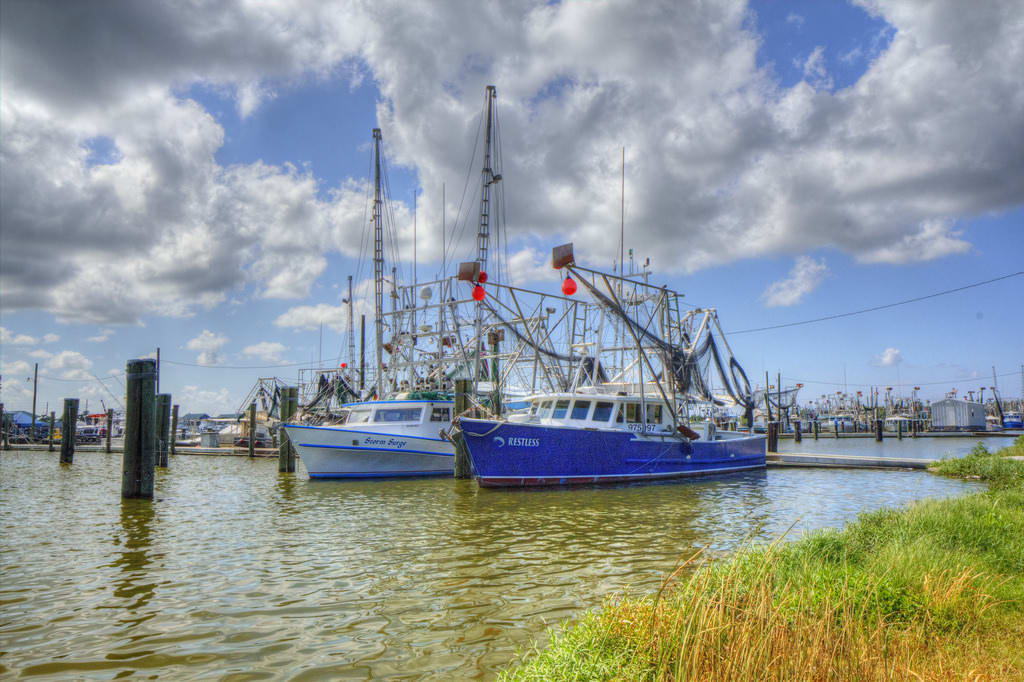
For a nearly complete tour of the landscapes Louisiana has to offer, the Creole Nature Trail fits the bill. It travels through rural farmlands, marshy flatlands, and even a portion of the Intracoastal Waterway. Seize the chance to view local wildlife like alligators and spoonbills at Sabine National Wildlife Refuge, watch the shrimpers bring in their catch along the coast, or tour the classic Victorian architecture in downtown Lake Charles.
No. 9 – Highway 307

Starting Location: Thibodeaux, LA
Ending Location: Raceland, LA
Length: 19 miles
Best Season to Drive: All
See drive on Google Maps
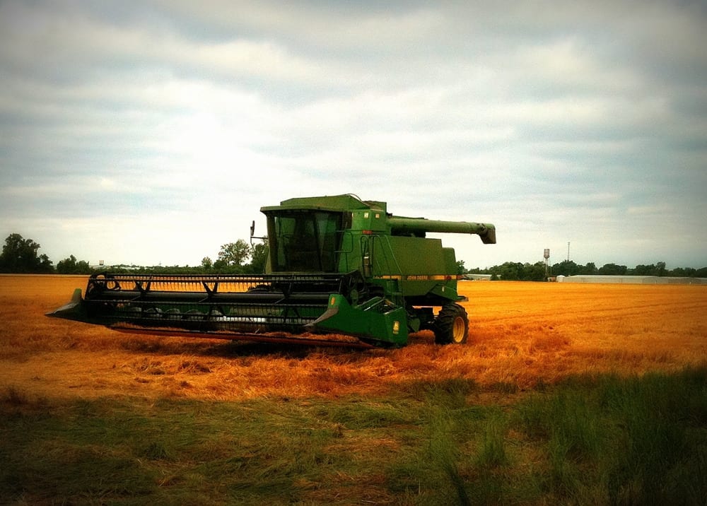
Pass through sleepy towns and cane fields on this leisurely ride over the ultra-smooth blacktop of Highway 307. Travelers along this way often don’t have to stop to see the state’s native wildlife up close because it’s not unusual to see a gator or other animal crossing the road. Near Kraemer, consider pulling off to relax by Lac des Allemandes, a lake with recreational opportunities like fishing and swimming.
No. 8 – Route 77 Bayous

Starting Location: Livonia, LA
Ending Location: Plaquemine, LA
Length: 36 miles
Best Season to Drive: All
See drive on Google Maps
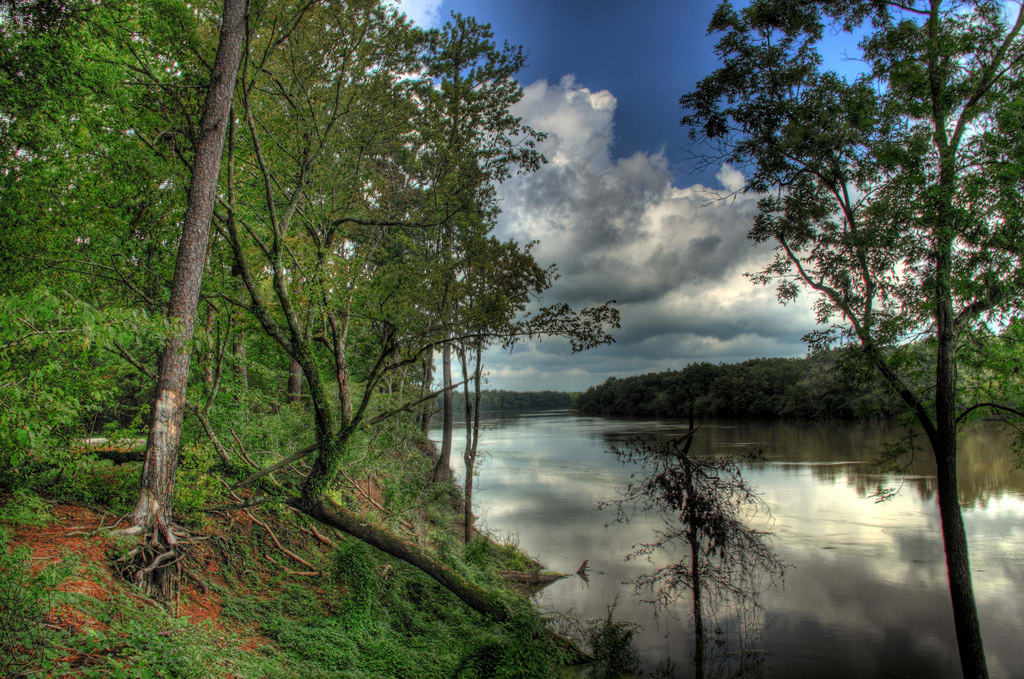
For travelers craving to see iconic Louisiana bayous, Route 77 certainly delivers. At any given time, it may seem like the world is divided between the farms and expansive fields on one side and stretching bayous on the other. Once in Plaquemine, take some time to peruse unique shopping opportunities in the historic downtown area or drive down to take a gander at the Mississippi River.
No. 7 – False River Route

Starting Location: Port Allen, LA
Ending Location: New Roads, LA
Length: 31 miles
Best Season to Drive: All
See drive on Google Maps
Without a lot of traffic on this winding trip, travelers this way can better enjoy rural scenes as they flit by windows. The route largely follows the levee of the False River, and its often sudden twists can keep drivers on their toes. In New Roads, don’t miss the local favorite, Satterfield’s Riverwalk and Restaurant, located right on the river where you can stroll down to the water between drinks or courses, or see many picturesque historic buildings along Main Street.
No. 6 – Mid-State 8
Starting Location: Leesville, LA
Ending Location: Sicily Island, LA
Length: 153 miles
Best Season to Drive: All
See drive on Google Maps
This route through the Louisiana backroads on Hwy 8 makes for a nice way to spend a morning or afternoon with a stop or two to explore. Near Bentley, check out Stuart Lake, which has a picnic area, camping, and plenty hiking trails to stretch your legs. Near Harrisonburg, there is easy access to the Ouachita River and its cool waters that make for a refreshing swim and are home to several trout varieties.
No. 5 – Maurepas

Starting Location: St. Vincent, LA
Ending Location: Ponchatoula, LA
Length: 32 miles
Best Season to Drive: All
See drive on Google Maps
Named for the nearby Lake Maurepas, this drive partially follows the Tickfaw River and goes through several quaint small towns. The two-lane road is mostly shaded by large oak trees, and scenes along the way show a slice of Cajun culture. There are ample opportunities to pull over to drop a line or dip a toe into the river, and check out the alligator cages in front of Paul’s Café in Ponchatoula.
No. 4 – Route 552 Loop
Starting Location: Downsville, LA
Ending Location: Downsville, LA
Length: 19 miles
Best Season to Drive: All
See drive on Google Maps
This winding road through rolling hills and pine-dotted woods provides a relaxing look at a more rural side of the state. Be sure to fuel up and pack any necessary provisions before starting out because there are no stores on the way – just spectacular views! For a break from the sprawling farms and ranches, consider a detour to the nearby D'Arbonne National Refuge & National Wildlife Area, where scores of outdoor recreational activities await.
No. 3 – Louisiana Bayou Byway

Starting Location: Lafayette, LA
Ending Location: New Orleans, LA
Length: 153 miles
Best Season to Drive: All
See drive on Google Maps
As this journey connects two of Louisiana’s most notable cities – Lafayette and New Orleans – this could easily make a weekend getaway to allow visitors time to become acquainted with both. Along the route, there is also an array of places to become more intimate with the region’s bayous and marshes. Stop in Lake Fausse Pointe State Park to hike the trails or canoe the cypress swamp, and the Bayou Teche National Wildlife Refuge is a prime place to spot alligators.
No. 2 – Longleaf Trail Scenic Byway

Starting Location: Bellwood, LA
Ending Location: Gorum, LA
Length: 23 miles
Best Season to Drive: All
See drive on Google Maps
Although the miles on this trip are few, travelers along this way will likely be surprised at the diversity of terrain and wildlife present on this route through the Kisatchie National Forest. From flat agricultural land to rocky bluffs with steep inclines, be prepared for just about anything – especially if you decide to hike one of the trails from the Longleaf Visitor Center. More adventurous types may consider a detour to the Kisatchie Bayou Recreation Area to try the Class II rapids in a kayak or canoe.
No. 1 – Cane River Heritage Trail

Starting Location: Allen, LA
Ending Location: Cloutierville, LA
Length: 48 miles
Best Season to Drive: All
See drive on Google Maps
This scenic route through the Cane River region is a virtual tour of Civil War history as well as a showcase for a wide variety of cultures, including Native American, French, and African peoples. In Natchitoches, explore the downtown historic district, which is full of specialty shops and restaurants of all flavors. Along LA-119, there are three Civil War era plantations that are open to the public – Oakland Plantation, Melrose Plantation, and Magnolia Plantation – all which provide a glimpse as to what life was like for both slaves and wealthy plantation owners in that period.