Nevada is comprised primarily of desert terrain, but that doesn’t mean there is nothing to see. Over thousands - even millions - of years, natural occurrences like erosion, high winds, and torrential rains have made this state’s land what it is today. From extraordinary geological formations to incredibly blue waters, Nevada proves that desert doesn’t mean devoid of beauty or things to see. In fact, the opposite is the case. See all of this state’s splendor for yourself, starting with one of these Nevada scenic drives:
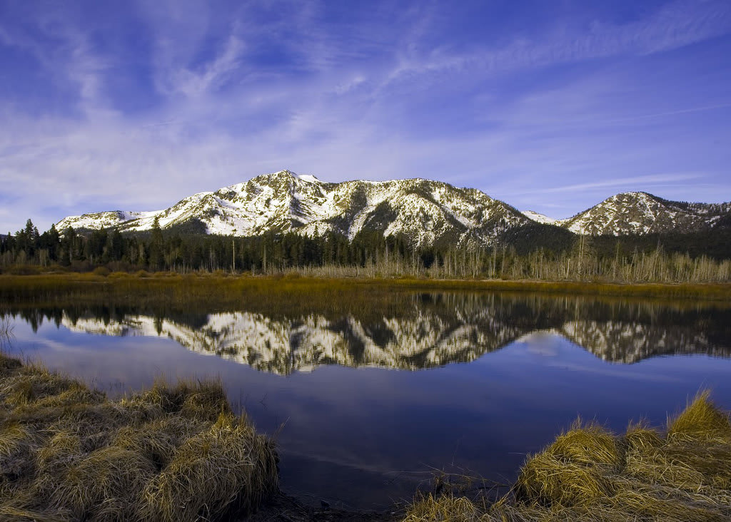
No. 10 – Mt. Rose Scenic Drive
Starting Location: Reno, NV
Ending Location: Lake Tahoe, NV
Length: 37 miles
Best Season to Drive: All
See this drive on Google Maps
No trip to Nevada is complete without a look at the ultra-blue Lake Tahoe, and this particular route is full of scenes to delight the eye along the way. The drive begins with a steep ascent through the desert into the mountains, affording sweeping views of the landscape below, then it abruptly transforms into dense woods on craggy slopes. Stop at Incline Village for an almost-aerial vantage of Lake Tahoe below, ideal for photos or just to allow its sight to soothe the soul.
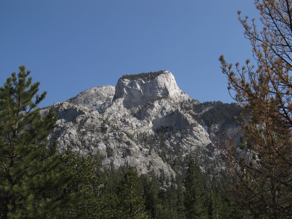
No. 9 – Mt. Charleston Loop
Starting Location: Las Vegas, NV
Ending Location: Las Vegas, NV
Length: 59 miles
Best Season to Drive: All
See this drive on Google Maps
Beginning and ending on the outskirts of the city that never sleeps, this drive provides a nice escape from the flashing lights and sounds of slot machines. The route travels right through the heart of the Mt. Charleston Wilderness Area, where there are plenty of trails to explore by foot or even on horseback. In the winter months, athletic types may wish to stop and hit the slopes at the Las Vegas Ski & Snowboard Resort on the way.
No. 8 – Walker River Scenic Drive
Starting Location: Yerington, NV
Ending Location: Hawthorne, NV
Length: 57 miles
Best Season to Drive: All
See this drive on Google Maps
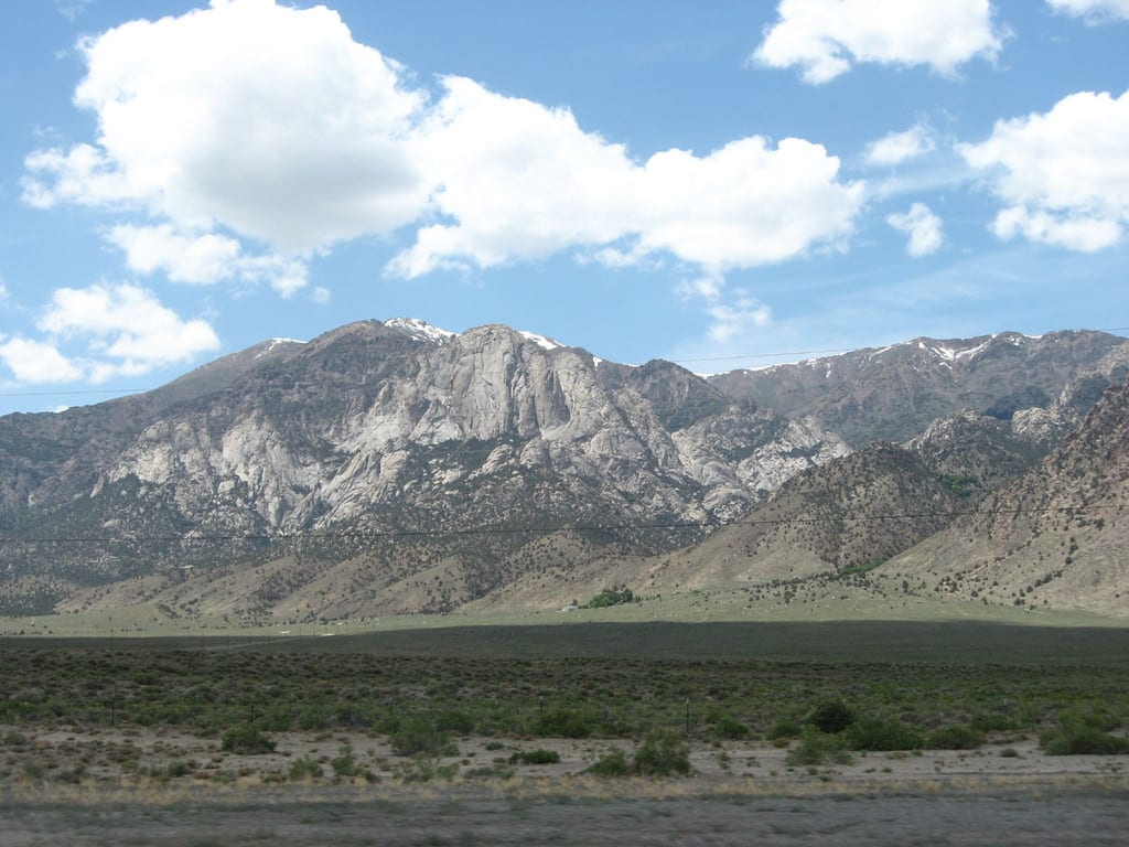
Stock up on fuel and snacks before setting out on this scenic drive that largely twists and turns with the East Walker River and past Walker Lake. There are no towns in between Yerington and Hawthorne, and few signs of civilization can be seen save for a sprinkling of ranches on the foothills of the Wassuk Range. Those choosing to drive this route, however, will gain unparalleled views of 11,239-foot Mt. Grant, the largest mountain in the area.
No. 7 – Rainbow Canyon Scenic Drive
Starting Location: Caliente, NV
Ending Location: Elgin, NV
Length: 22 miles
Best Season to Drive: All
See this drive on Google Maps
This ride through the deep Rainbow Canyon, situated between the Delamar and Clover Mountains, is noteworthy for its array of multicolored rock formations on either side of the road. One of the more unusual sights along this way is a sprinkling of cottonwood trees fed by the trickling waters of the Meadow Valley Wash in an otherwise desert terrain. For those wanting to hike or camp, the nearby Clover Mountains Wilderness Area is a prime location.
No. 6 – Angel Lake Scenic Drive

Starting Location: Wells, NV
Ending Location: Angel Lake, NV
Length: 13 miles
Best Season to Drive: Spring, Summer, and Fall
See this drive on Google Maps
Although this route is relatively short, it isn’t short on panoramic views of the Humboldt Mountains, making it well worth the detour (with a jacket in tow) for travelers in the area. This isn’t a region that attracts many tourists, and natives rarely visit outside of the summer months due to the year-round cold temperatures. At the end of the drive lies Angel Lake, which is surprisingly clear when not covered with ice.
No. 5 – Big Smoky Valley Scenic Drive
Starting Location: Tonopah, NV
Ending Location: Austin, NV
Length: 118 miles
Best Season to Drive: All
See this drive on Google Maps
Nestled between the tall Toiyabe Range and the slightly more distant Toquima Range, there is no shortage of mountain views on this relatively unpopulated route. Travelers this way, however, will have a handful of opportunities to refuel and explore in the small and strangely quaint towns of Hadley, Carvers, and Kingston. Stop just outside Hadley to take a peek at the gigantic gold mine and fantasize about taking a bit of loot with you as a souvenir.
No. 4 – Valley of Fire Highway
Starting Location: Moapa Valley, NV
Ending Location: Crystal, NV
Length: 36 miles
Best Season to Drive: All
See this drive on Google Maps
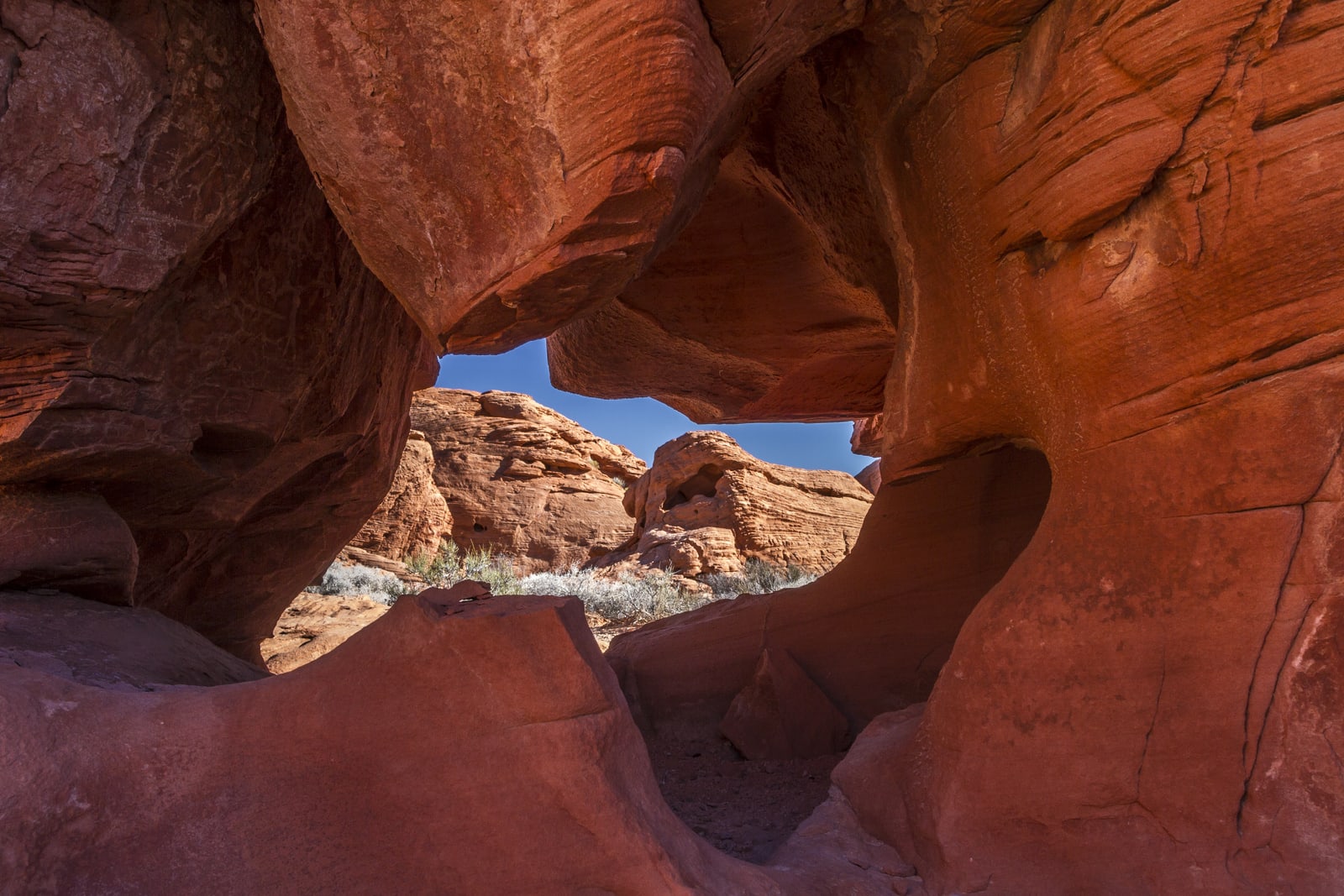
This trip through the Valley of Fire State Park treats travelers to views of fascinating red sandstone formations carved by the elements over thousands of years. Take time to pull over and see a few of these unusual rocks up close, especially at Elephant Rock Vista and Seven Sisters Vista. Hike the one-mile Petroglyph Canyon Trail to be rewarded with the sight of age-old Native American cave drawings that have managed to survived a harsh environment and countless generations.
No. 3 – Lamoille Canyon Scenic Byway

Starting Location: Lamoille, NV
Ending Location: Elko, NV
Length: 20 miles
Best Season to Drive: Spring, Summer, and Fall
See this drive on Google Maps
As travelers wind through this canyon tucked between the Ruby Mountains, they will be delighted with panoramic views, year-round snow fields, and cascading waterfalls. Take a break at Humboldt-Toiyabe National Forest to hike a trail or two and examine the landscape more closely. The Terraces Picnic Area is another good place to find trails or just take time out to enjoy time amid willow and aspen trees.
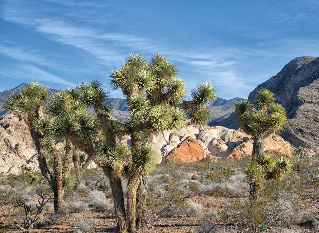
No. 2 – Red Rock Canyon Loop
Starting Location: Las Vegas, NV
Ending Location: Las Vegas, NV
Length: 49 miles
Best Season to Drive: All
See this drive on Google Maps
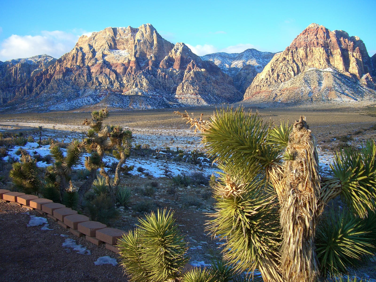
Visitors in search of winning their fortune can take a break from the strip to view geological wonders like sandstone cliffs and interesting rock formations on this loop through Red Rock Canyon. Stop at the Red Rock Canyon Visitor Center and bone up on the region’s history and local wildlife to better appreciate the sights. Hiking trails abound, with the four-mile White Rock and Willow Springs trail being one of the most popular, and don’t miss the photo opportunities at the Red Rock Canyon Overlook.
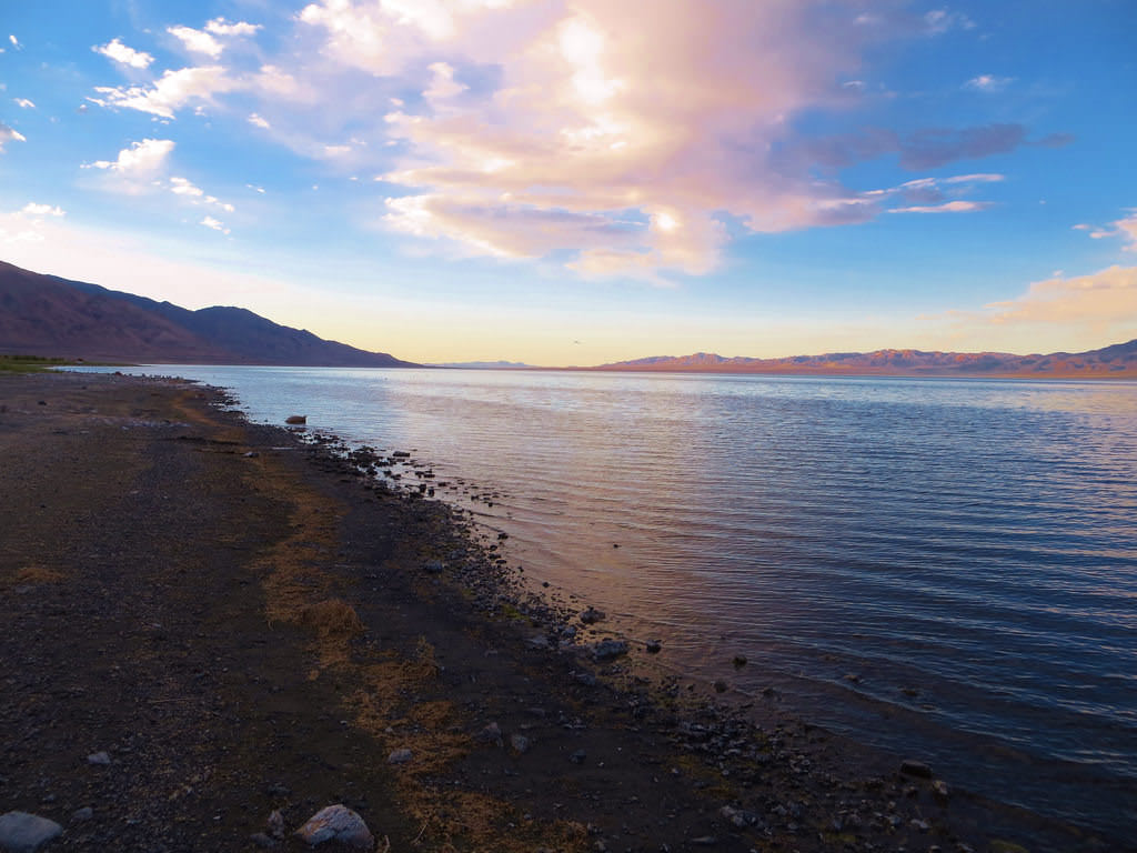
No. 1 – Pyramid Lake Scenic Byway

Starting Location: Spanish Springs, NV
Ending Location: Fernley, NV
Length: 55 miles
Best Season to Drive: All
See this drive on Google Maps
Although this drive is situated smack dab in the middle of the desert, the route passes over and through some varied terrain, beginning with the Virginia Mountains and ending with a descent to the ultra-blue Pyramid Lake. Natural tufa rock formations along the way make for amazing photo opportunities. Bird enthusiasts may want to take a brief detour, with binoculars in hand, above the Anaho Island National Wildlife Refuge to view an array of migrating birds and a large colony of American White Pelicans. In Nixon, stop at the Pyramid Lake Museum and Visitor Center to learn more about the area.