It is difficult to characterize New Mexico with its array of cultural influences and diverse terrains. From sweeping desert lands to verdant forests to regions that look more like the surface of a distant planet than a part of Earth, a person could spend years of exploration without uncovering a fraction of this state’s hidden treasures. Unfortunately, the average visitor to this region doesn’t have eons to spend. So, gain a good overview of what this place has to offer by taking one of our favorite New Mexico scenic drives:
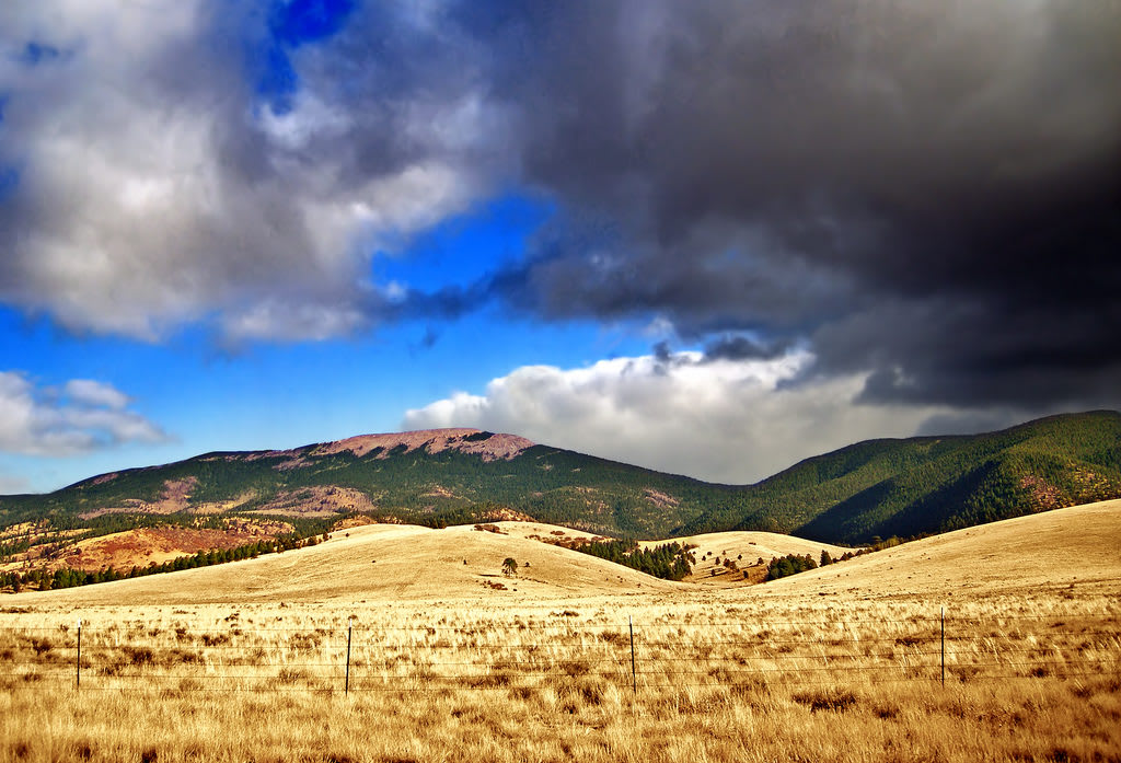
No. 10 – El Malpais National Monument

Starting Location: Grants, NM
Ending Location: Quemado NM
Length: 86 miles
Best Season to Drive: All
See this drive on Google Maps
For an otherworldly experience, this route through ancient lava beds and by twisted rock formations fits the bill. The El Malpais National Monument Visitor Center just outside Grants educates travelers on the lava flows and about the Native Americans that lived in the area for approximately 10,000 years. La Ventana Natural Arch, the state’s second-largest natural arch, is a popular spot for photos, while hikers may enjoy the trails off of The Narrows.
No. 9 – Lake Valley Back Country Byway

Starting Location: Hillsboro, NM
Ending Location: Deming, NM
Length: 30 miles
Best Season to Drive: All
See this drive on Google Maps
Driving through mining country and small towns with one foot firmly planted in the past, this route almost transports travelers back in time. The small town of Hillsboro is full of historic buildings from the 1800s, such as the 1879 Miller Drug Store which now functions as a café and the picturesque 1892 Union Church. The ghost town of Lake Valley, however, is the main attraction, where you can still see the remains of its Main Street ravaged by fire long ago.
No.8 – Turquoise Trail
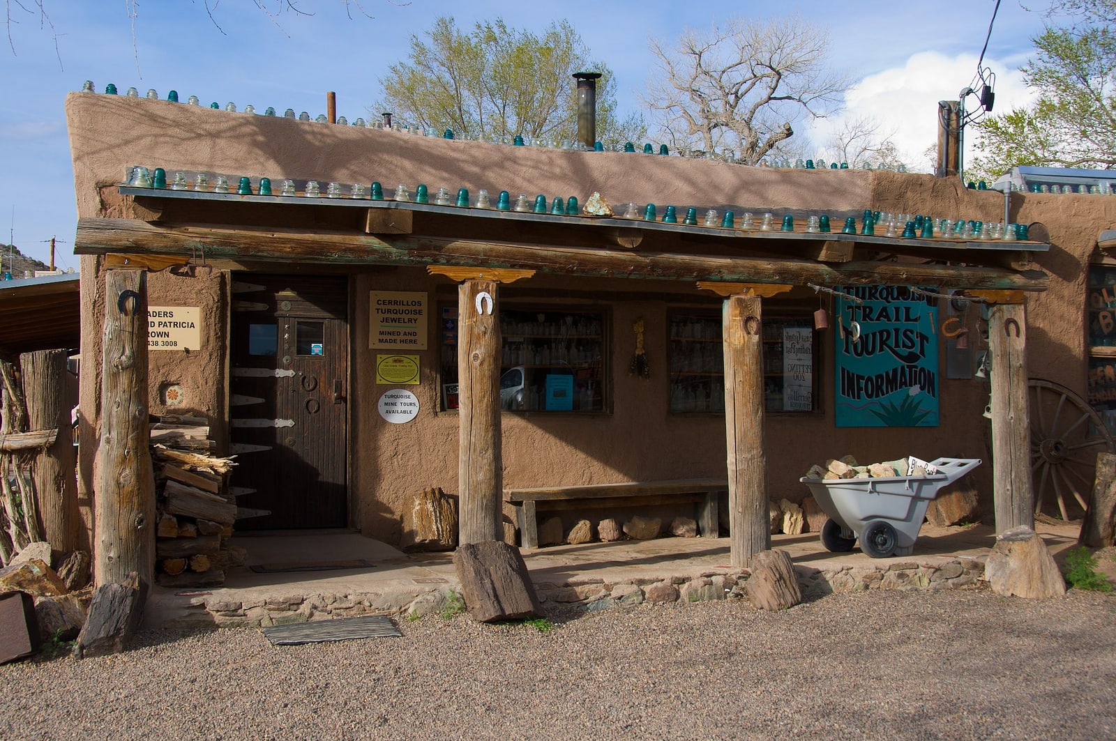
Starting Location: Albuquerque, NM
Ending Location: Santa Fe, NM
Length: 72 miles
Best Season to Drive: All
See this drive on Google Maps
This route named for the array of turquoise deposits discovered in the area goes through a particularly pretty landscape marked by sweeping canyons, mountains, and sleepy towns. Stop at the Museum of Archaeology and Material Culture to learn about the people who once called this region home, while a tour of Tinkertown Museum just outside Cedar Crest can lighten the mood with its odd collection of hand-carved wooden miniatures. For outdoor fun, stop in Cerrillos Hills State Park, which is full of foot and bike trails.
No. 7 – High Road to Taos
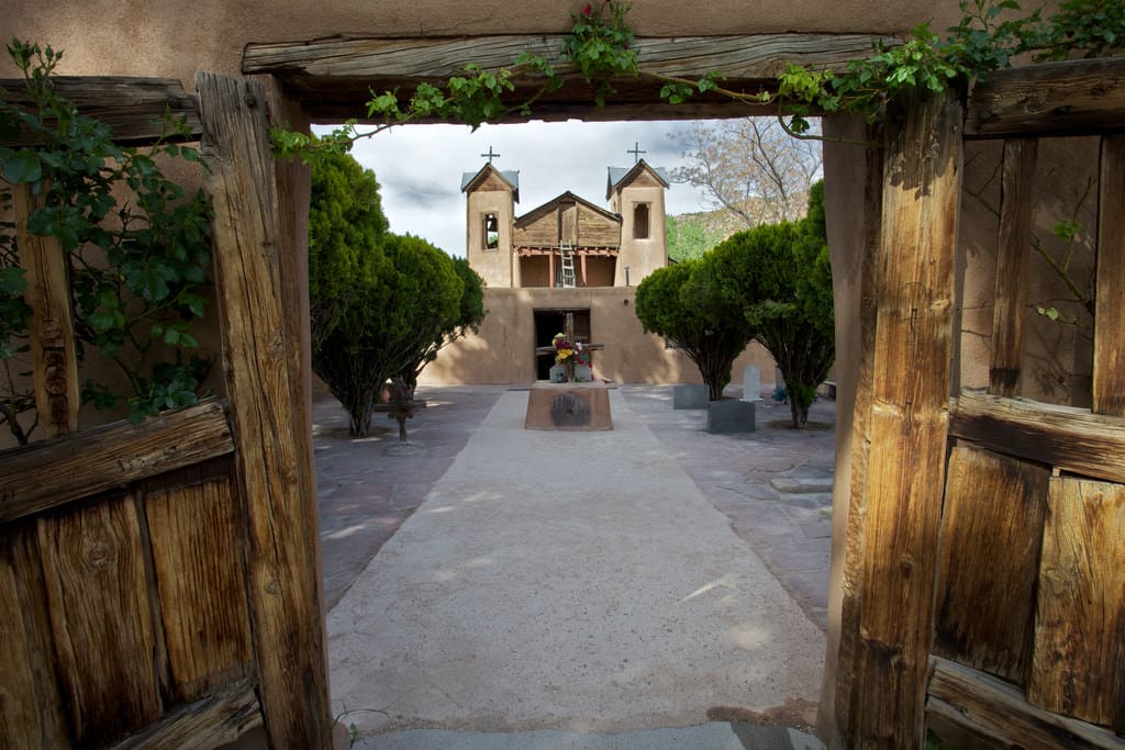
Starting Location: Santa Fe, NM
Ending Location: Taos, NM
Length: 76 miles
Best Season to Drive: All
See this drive on Google Maps
Passing through the Sangre de Cristo Mountains, this route is rich in the history and culture of early Native Americans and Spanish settlers. In Chimayó, touring the Plaza del Cerro is a must, as it is the most well-preserved Spanish Plaza in the state. Also, take advantage of the fabulous photo opportunities at the Truchas Overlook with views of the 13,102 foot Truchas Peak and the Rio Grande Valley or in the forests of Carson National Forest.
No. 6 – Jemez Mountain Trail

Starting Location: White Rock, NM
Ending Location: Jemez Springs, NM
Length: 149 miles
Best Season to Drive: Summer and Fall
See this drive on Google Maps
This route passes through both desert and wooded mountain terrain, providing a varied look at the New Mexico landscape. See Anasazi Native American cliff dwellings at Bandelier National Monument, or hike one of the two fee-free trials at Valles Caldera, the site of a collapsed volcano. To escape the desert heat, consider wading by Jemez Falls or immersing completely in Fenton Lake.
No. 5 – Geronimo Trail
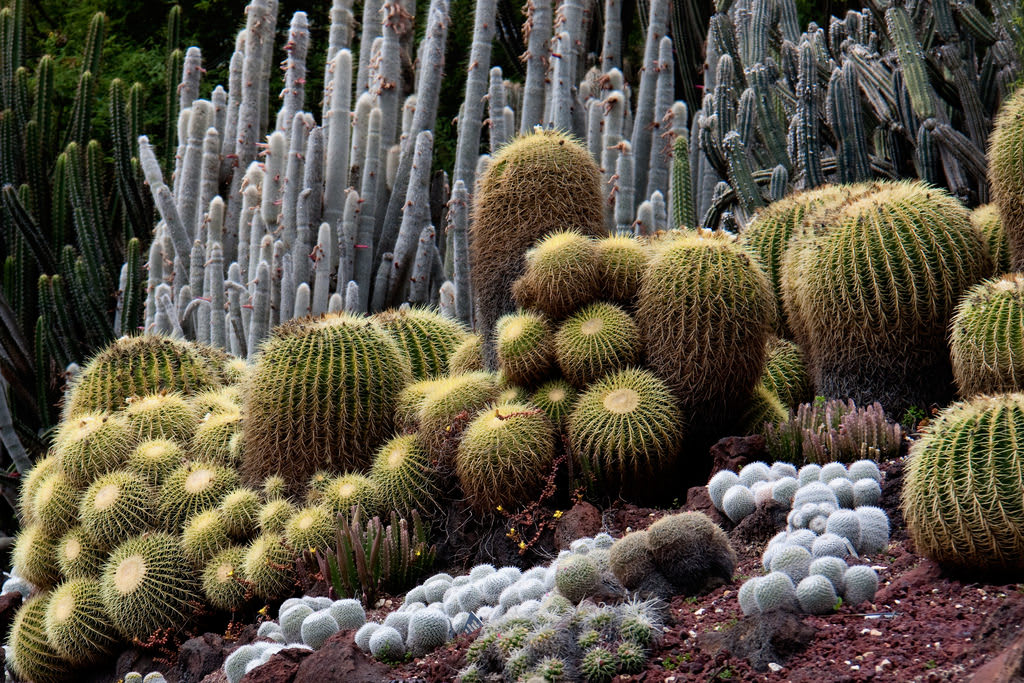
Starting Location: Magdalena, NM
Ending Location: Hanover, NM
Length: 149 miles
Best Season to Drive: All
See this drive on Google Maps
Honoring the Apache chief Geronimo, this route twists and turns through the pine forests and volcanic rock formations of the Black Range Mountains. Stop in Caballo Lake State Park to see the cactus gardens, go for a swim, or just sit back to watch for frequently seen Bald and Golden eagles. To take relaxation to new levels, take a bath in the geothermal hot springs of the oddly named town of Truth or Consequences.
No. 4 – Billy the Kid Trail

Starting Location: Ruidoso Downs, NM
Ending Location: Ruidoso Downs, NM
Length: 72 miles
Best Season to Drive: All
See this drive on Google Maps
This drive largely following Gavilan Canyon Road retraces some of the footsteps (or horse steps) of famed outlaw Billy the Kid and loops through the Lincoln National Forest. The Hubbard Museum of the American West in Ruidoso Downs provides some good historical background on the area. Don’t miss the Smokey Bear Historical State Park in Capitan where the real Smokey the Bear was found clinging to a tree as a baby in 1950 after a forest fire.
No. 3 – Trail of the Mountain Spirits

Starting Location: Silver City, NM
Ending Location: Silver City, NM
Length: 80 miles
Best Season to Drive: Spring
See this drive on Google Maps
Beginning and ending in Silver City, notable for its turquoise and copper mines, this route loops through seemingly never-ending verdant hills and by ancient cliff dwellings. Anderson Scenic Overlook provides good photo opportunities of the Gila River Canyon while the Gila Cliff Dwellings Historic Monument honors the Tularosa Mogollon people who lived in the nearby interconnected caves in the 1200s. For more traditional outdoor activities like hiking or picnicking, stop at Lake Roberts near Mimbres.
No. 2 – Enchanted Circle
Starting Location: Taos, NM
Ending Location: Taos, NM
Length: 91 miles
Best Season to Drive: All
See this drive on Google Maps
Looping around New Mexico’s largest mountain, Wheeler Peak, this route provides rugged and sweeping views of a landscape reminiscent of the Old West. Stop in Eagle Nest not only to see 13,161 foot Wheeler Peak and 12,441 foot Baldy Mountain but also to try your luck at catching Kokanee Salmon and Rainbow Trout in Eagle Nest Lake. In Cimarron Canyon State Park, take time to explore the trails while keeping eyes peeled for local wildlife like bear, mule deer, and grouse.
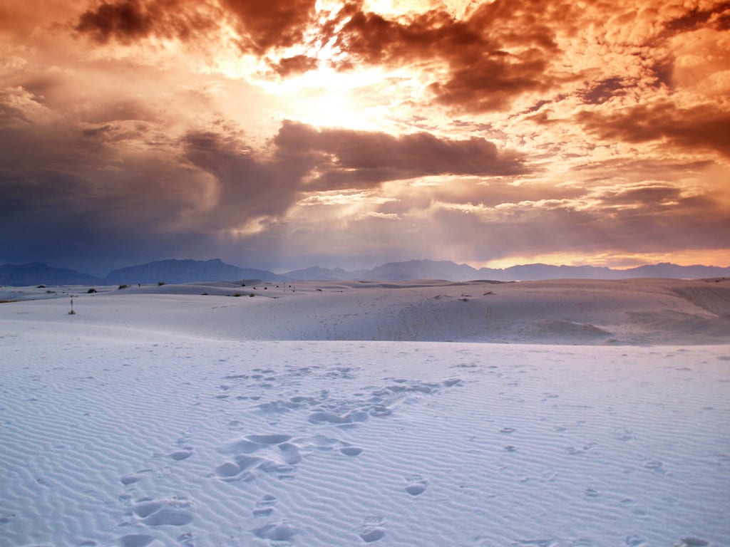
No. 1 – White Sands National Monument
Starting Location: Alamogordo, NM
Ending Location: White Sands National Monument, NM
Length: 17 miles
Best Season to Drive: All
See this drive on Google Maps
While this scenic drive isn’t very long, it has the potential to define a traveler’s experience in New Mexico by virtue of its outstanding views of a surreal landscape. To truly savor what this route has to offer, it requires pulling off the road and exploring the White Sands National Monument on foot to see the dunes of ultra-white sand up close. There are several trail options tailored to different fitness levels from a 650-yard stroll on the Interdune Boardwalk to a 4.6-mile hike on the Alkali Flat Trail.